
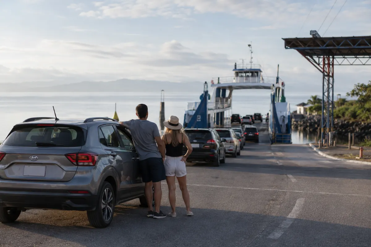
Costa Rica Driving Routes: Road Trip Planning Guide
Official Alamo, National & Enterprise Partner. Zero risk, no credit card required online.



Costa Rica Driving Routes: Plan Your Rental Car Trip
Costa Rica driving routes can look surprisingly short on a map, but travel time, road type and driving difficulty vary considerably between regions.
The best route depends on your exact starting point, destination, weather, traffic, ferry requirements and final accommodation access. Rather than choosing a route based only on distance, review the roads you will actually use and plan longer or unfamiliar drives for daylight whenever possible.
If you are renting a car, choose the vehicle after you understand the conditions along your itinerary.
How to Plan a Driving Route in Costa Rica
Start with the exact pickup point and exact accommodation address, not simply the nearest town.
Two hotels in the same destination can have very different final access roads. One may be reached entirely by paved roads while another may require a steep, narrow or unpaved final section.
Before departure, check:
Main roads on the route.
Current traffic conditions.
Weather.
Road construction or temporary restrictions.
Ferry or boat connections.
Final hotel or villa access.
Fuel requirements.
Expected toll roads.
Whether additional ground clearance or four-wheel drive is advisable.
Costa Rica's national road system includes major highways, secondary roads and local access roads. Temporary construction, weather events and traffic management can change the most practical route.
Once your itinerary is clear, check current vehicle availability for your dates and select a category suited to the roads, number of passengers and luggage.
Driving Routes From San José and SJO Airport
Juan Santamaría International Airport (SJO), near Alajuela, is one of Costa Rica's principal starting points for rental car trips.
It provides road access toward Arenal, the Central Pacific, South Pacific, Caribbean, Central Valley and Nicoya Peninsula.
Popular driving directions include:
San José or SJO to La Fortuna and Arenal.
San José or SJO to Monteverde.
San José or SJO to Jacó.
San José or SJO to Manuel Antonio and Quepos.
San José or SJO to Dominical and Uvita.
San José or SJO to Puerto Viejo and the South Caribbean.
San José or SJO to Montezuma.
San José or SJO to Santa Teresa.
Routes toward Costa Rica's Central Pacific commonly use Route 27 before connecting with Route 34, also known as the Costanera Sur, for destinations farther south.
Routes toward Limón and the Caribbean commonly use Route 32.
Trips toward the southern Nicoya Peninsula may involve the Puntarenas–Paquera ferry rather than driving the entire way around the Gulf of Nicoya.
Review the San José Airport car rental guide when planning a rental that begins near SJO.
Driving Routes From Liberia and Guanacaste Airport
Guanacaste Airport (LIR), near Liberia, is particularly convenient for rental car trips through Guanacaste and Costa Rica's North Pacific.
It can also serve as a starting point for inland drives toward Arenal and Monteverde.
Popular routes include:
Liberia or LIR to Tamarindo.
Liberia or LIR to Papagayo.
Liberia or LIR to Playas del Coco.
Liberia or LIR to Playa Hermosa.
Liberia or LIR to Flamingo.
Liberia or LIR to Brasilito and Playa Conchal.
Liberia or LIR to Las Catalinas.
Liberia or LIR to Nosara.
Liberia or LIR to Sámara.
Liberia or LIR to La Fortuna.
Liberia or LIR to Monteverde.
Road conditions can range from major paved highways to smaller coastal and hotel-access roads.
The fact that a destination is in Guanacaste does not automatically determine which vehicle you need. Check the final access road to the exact accommodation before booking.
Review the Liberia Airport car rental guide when planning a rental that begins at LIR.
Driving Between Major Costa Rica Destinations
Many travelers use a rental car not only from the airport but also between Costa Rica's major tourism regions.
Common combinations include:
La Fortuna to Monteverde.
La Fortuna to Manuel Antonio.
La Fortuna to Tamarindo.
Monteverde to Tamarindo.
Monteverde to Manuel Antonio.
Puerto Viejo to La Fortuna.
Santa Teresa to Monteverde.
Santa Teresa to La Fortuna.
A straight line on a map can be misleading.
Costa Rica's mountains, Lake Arenal, the Gulf of Nicoya, ferry logistics and road network can make the practical driving route considerably longer than the geographic distance between two destinations suggests.
Use individual route guides whenever possible rather than estimating a travel day from distance alone.
Central Pacific Driving Routes
Costa Rica's Central Pacific is one of the most straightforward regions for building a multi-stop road itinerary.
Important destinations include:
Jacó.
Herradura and Los Sueños.
Quepos.
Manuel Antonio.
Travel from the Central Valley commonly uses Route 27 toward the Pacific before connecting with coastal routes.
Traffic, construction and weekend travel patterns can affect journey times, particularly when traveling between San José and the Pacific.
South Pacific Driving Routes
Route 34, the Costanera Sur, is the principal coastal corridor for many South Pacific destinations.
It connects or provides access toward:
Jacó.
Quepos.
Manuel Antonio.
Dominical.
Uvita.
Ojochal.
Sierpe.
Golfito.
Roads leading toward the Osa Peninsula.
A multi-stop Pacific itinerary can work particularly well by rental car because several destinations follow the same broad north-south corridor.
However, construction, bridge work, heavy rainfall and local accommodation roads can still change individual sections.
Driving Toward the Osa Peninsula
Trips farther south require additional planning.
Destinations such as Puerto Jiménez and other areas of the Osa Peninsula can involve significantly longer drives and more remote road sections than the Central Pacific.
Confirm:
Fuel availability.
Final accommodation access.
Road conditions.
Daylight.
Vehicle recommendations from the accommodation.
Do not assume that every Osa destination should be approached the same way.
Can You Drive a Rental Car to Drake Bay?
Drake Bay requires different planning from a conventional point-to-point rental car destination.
Many travelers drive to Sierpe, park there and continue by passenger boat to Drake Bay.
This can be more practical than treating Drake Bay as a standard rental-car destination.
Travelers who plan to leave a rental vehicle while continuing by boat should confirm parking arrangements, boat timing and rental conditions in advance.
Routes Using the Puntarenas–Paquera Ferry
The Puntarenas–Paquera ferry carries both passengers and vehicles across the Gulf of Nicoya.
It can be useful when driving from the Central Valley or Central Pacific toward:
Paquera.
Tambor.
Cóbano.
Montezuma.
Mal País.
Santa Teresa.
Using the ferry can avoid driving around the entire Gulf of Nicoya.
Allow sufficient time for:
Driving to the Puntarenas ferry terminal.
Vehicle check-in and boarding.
The ferry crossing.
Vehicle unloading in Paquera.
The remaining drive to your destination.
The service is currently operated by Naviera Tambor under an authorized public concession.
Ferry departure times, fares and vehicle-boarding procedures can change. Verify the current schedule before travel, particularly when your itinerary depends on a specific sailing.
Do You Need a Ferry to Drive Around Costa Rica?
No.
Most Costa Rica driving routes do not require a ferry.
The Puntarenas–Paquera ferry is primarily useful for certain trips involving the southern Nicoya Peninsula.
Travelers can also reach Nicoya Peninsula destinations entirely by road, but the preferred route depends on the origin, destination and current conditions.
Do Costa Rica Driving Routes Have Tolls?
Some routes do.
Route 27 has toll stations between the Central Valley and the Pacific corridor, and toll collection also exists on other national routes.
Toll amounts and payment arrangements can change.
Keep some Costa Rican colones available and follow current signage at each toll station rather than relying on an old published amount.
For additional road information, review the Driving in Costa Rica guide.
How Accurate Are Costa Rica Driving Times?
Treat Costa Rica driving times as planning estimates rather than guaranteed arrival times.
Actual travel time can be affected by:
Traffic.
Mountain roads.
Trucks.
Road construction.
Heavy rain.
Fog.
Ferry timing.
Accidents.
Urban congestion.
Food or fuel stops.
Final accommodation access.
Navigation apps are useful, but their estimated arrival time does not always reflect every local road condition.
For long routes, build extra time into the travel day and check the route again before departure.
Avoid scheduling a critical tour, ferry, boat or flight connection immediately after a long drive without a reasonable time margin.
Should You Follow the Shortest Route on a Navigation App?
Not automatically.
Google Maps, Waze or another navigation application may identify a smaller road as the shortest route.
That route may be perfectly suitable, but it can also involve:
Narrower roads.
Unpaved surfaces.
Steeper grades.
Seasonal conditions.
More difficult final access.
When an unfamiliar shortcut looks questionable, confirm the road with your accommodation, rental provider or another reliable local source.
The fastest-looking route on a screen is not always the most practical route for your vehicle.
Do You Need a 4x4 for Costa Rica Driving Routes?
Not automatically.
Many major airport-to-destination and intercity routes use paved national highways.
The more important question is what happens after you leave the main road.
A standard rental vehicle may be appropriate for itineraries that remain on paved roads.
A higher-clearance vehicle can be useful for rougher secondary or hotel-access roads, while four-wheel drive becomes more relevant when roads are steep, unpaved, irregular or otherwise specifically require it.
Check every accommodation and important activity access road before selecting the vehicle.
You can compare vehicle categories on the Costa Rica rental car vehicles page.
Plan Long Driving Days for Daylight
For unfamiliar or longer Costa Rica routes, daylight usually makes driving easier.
This is particularly useful when your trip includes:
Mountain roads.
Rural roads.
Unpaved sections.
Heavy rain.
Fog.
Narrow bridges.
Unfamiliar hotel access.
If your international flight arrives late, consider whether starting a long drive immediately is necessary.
An airport transfer followed by a rental car the next day can sometimes produce a more comfortable itinerary.
When a Shuttle May Be Better Than Driving
A rental car provides flexibility, but it is not automatically the best option for every leg of a trip.
A shared or private shuttle may be more practical when:
Your international flight arrives late.
You face a long one-way transfer.
You do not need a vehicle at the destination.
Ferry or boat timing creates additional logistics.
You prefer not to drive an unfamiliar route.
You want to begin the rental later in the itinerary.
A hybrid itinerary can also work well.
For example, travelers can use transportation for the most demanding transfer and receive or collect a rental vehicle later where independent exploration adds more value.
See the Costa Rica rental car delivery guide for information about starting a rental after reaching a destination.
Which Airport Is Better for a Costa Rica Road Trip?
Neither airport is automatically better for every itinerary.
San José International Airport — SJO
SJO is particularly well positioned for:
Central Valley destinations.
Arenal.
Caribbean itineraries.
Central Pacific.
South Pacific.
Routes toward the southern Nicoya Peninsula.
Guanacaste Airport — LIR
LIR is particularly convenient for:
Papagayo.
Playas del Coco.
Tamarindo.
Flamingo.
Conchal.
Las Catalinas.
Nosara.
Sámara.
Other Guanacaste and North Pacific destinations.
It can also work for Arenal and Monteverde.
The best airport depends on the complete itinerary rather than one destination alone.
Before Starting a Long Costa Rica Driving Route
Before departure, confirm:
Exact destination pin.
Main roads.
Final accommodation access.
Current traffic.
Weather.
Construction or restrictions.
Ferry schedule if applicable.
Toll requirements.
Fuel level.
Vehicle suitability.
Estimated daylight.
Roadside-assistance contact information.
For complicated itineraries, review each driving leg separately rather than treating the entire trip as one route.
Frequently Asked Questions
What is the best driving route in Costa Rica?
There is no single best route.
The most practical route depends on your origin, destination, traffic, weather, road conditions and final accommodation access.
Use route-specific information rather than choosing only the shortest line displayed by a navigation application.
Can I drive from San José Airport to the Pacific coast?
Yes.
Major Central and South Pacific destinations are accessible by road from SJO.
Route 27 is an important corridor from the Central Valley toward the Pacific, while Route 34 continues along the coast toward destinations including Jacó, Quepos, Dominical and Uvita.
Can I drive from Liberia Airport to the beaches?
Yes.
Guanacaste Airport is particularly convenient for destinations including Papagayo, Playas del Coco, Tamarindo, Flamingo, Brasilito, Playa Conchal and other areas of the North Pacific.
Check the final accommodation access before selecting a vehicle.
Do I need a ferry to drive around Costa Rica?
Most routes do not require a ferry.
The Puntarenas–Paquera ferry is useful for certain journeys toward the southern Nicoya Peninsula, including Paquera, Montezuma and Santa Teresa.
Can rental cars go on the Puntarenas–Paquera ferry?
The Puntarenas–Paquera ferry carries vehicles.
Travelers using a rental car should also follow any applicable rental-company terms and current ferry boarding procedures.
Should I trust Google Maps or Waze for every Costa Rica route?
Navigation apps are useful for directions and traffic, but verify road type, hotel access, ferry requirements and seasonal conditions before accepting an unfamiliar shortcut.
A shorter route can sometimes involve a smaller or more difficult road.
Are Costa Rica driving times reliable?
Use them as estimates rather than promises.
Traffic, terrain, weather, construction, ferries and stops can increase travel time.
Build a reasonable margin into longer travel days.
Do I need a 4x4 for a Costa Rica road trip?
Not necessarily.
Many common intercity routes are paved.
Choose the vehicle according to the exact roads and accommodation access on your itinerary rather than assuming that every Costa Rica road trip requires four-wheel drive.
Is SJO or LIR better for a road trip?
It depends on your itinerary.
SJO is well positioned for the Central Valley, Caribbean, Arenal and much of the Central and South Pacific.
LIR is especially convenient for Guanacaste and the North Pacific.
A multi-destination trip should be evaluated as a complete route rather than choosing an airport based on only one stop.
Plan Your Costa Rica Rental Car Route
Costa Rica is well suited to independent road trips when travelers plan around actual road conditions rather than distance alone.
Start with your airport or pickup location, identify the exact accommodations on your itinerary, determine whether ferries or difficult access roads are involved and then choose the rental vehicle.
Use route-specific guides for individual journeys and allow additional time for weather, traffic, road construction and stops.
Explore car rental in Costa Rica and check current vehicle availability once your driving itinerary is clear.